
Land-use planning (Kaiser and Godschalk 1995) and regulation (Popper 1988) is a core responsibility of municipal governments. At the core of urban land-use planning and decision-making are normative conflicts inherent in the very meanings of land (Radin 1982; Wolford 2007): land as bounded territory, as the soil beneath our feet, or as the subjective realm of identity and personhood. To enable decision-making about land, by elected and appointed municipal officials, governments rely on a range of ways to analyze, categorize, and influence land and its uses, producing artifacts like maps, visions, scenarios, ordinances, codes, guidelines, and stories (Kaiser and Godschalk,1995; Sandercock 2003; Kim 2015). In this article, we aim to complicate the concept of “land” in metropolitan land-use planning and decision-making. Following Haila’s call that “[t]he question of special or non-special characteristics of land cannot be solved a priori [emphasis in original] at an abstract level, but only by analyzing those real processes through which land is used and invested in” (1991, p. 345), we investigate governance instruments like transfer of development rights (TDR) and ecosystem service markets (ESM), both of which have gained popularity as market-like mechanisms for dealing with land-use conflicts. The underlying premise of these instruments is their compensatory logic: the idea that creating a similar resource at some other location, frequently in different (municipal) jurisdictions, can offset the ecological or social value of a certain site. We focus on two market-like instruments—TDR and ESM—to highlight the work involved in what we call the separation and stabilization of these new markets, and their implications for urban local governments.
A key assumption underlying TDR and ESM is the possibility of separation: of loosening, and effectively severing, the connection between a particular plot of land and the social, ecological, and economic meanings and values associated with that land. In other words, these instruments rely on a logic of separating key attributes from specific pieces of land, be it the ability to develop a site in certain ways, the environmental benefits a patch produces, or the tax revenue a parcel might yield in future decades. A successful TDR market or ESM requires a development right or a water-quality credit to be traded across space. From the perspective of municipal government, this means that creating or participating in a market-like instrument creates a new kind of relationship with sites and structures outside the immediate spatial boundaries of the site of construction or impact. Inherent in this act of separation is the assumption that riparian functions or air rights are commensurable across geographical distance and jurisdictional boundaries; that it does not matter if an extra floor of a building or an extra tree is delinked from place and transferred to another place. Not only are these market-like instruments premised on logics of separation, but it takes immense work to stabilize these mechanisms and to make them appear natural or taken for granted. The creation of TDR and ESM regimes requires work, which ranges “from analytical techniques to pricing models, from purchase settings to merchandising tools, from trading protocols to aggregate indicators” (Callon 2009; MacKenzie et al. 2008). We use specific examples from TDRs in New York and ESMs in Oregon to show how these new instruments can produce ineffective and undesirable outcomes when the logics of separation and stabilization are rendered invisible.
Transfer of development rights
In New York City, the 1961 zoning laws introduced the floor-area ratio (FAR), a land-use instrument to regulate building density, and, associated with it, the TDR. The TDR is a market-oriented strategy to offset regulatory burdens: any development rights that could not be utilized on a plot of land due to regulatory restrictions like landmark preservation could be transferred to another plot. At its core, the TDR program is a legal maneuver in property rights, where ownership over land is separated from ownership over the development rights on that land. Aptly referred to by the legal scholar John Costonis as “space adrift” (1984), the TDR program creates a new market in air rights, where air rights are delinked from terra firma so that they can be exchanged and assembled across space (also see Marcus 1983; Furman Center for Real Estate and Urban Policy 2013; Sorkin 2018). In the parlance of real estate, “air is simply invisible land, because you can build on it. Sometimes the air above, behind, to the left or right is worth far more than the building that carries the rights to it; it’s a potential pot of gold for many properties.” It is for this reason that the Portuguese term for TDR is sol criado, literally “created land.” The 1961 New York City land-use innovation of TDR traveled to other cities including Mumbai and São Paulo. In the post-1980s era of fiscal austerity, TDR has gained attention as a source of public revenues.
The logic of separation that underlies the TDR market is premised on the assumption of fungibility, that development rights are interchangeable across space. This fungibility of development rights is enabled by the FAR, which regulates how much of the space above a plot of land can be commodified in the form of private property, such that “the public right of access to sun and air is protected” (Sorkin 2018). In other words, the FAR is the abstract representation of a contested terrain between private property and public good, between enclosure and air (Graham and Hewitt 2013; Chen 2020). When the space above a plot of land is coded as FAR, it sets up a regulatory system where commodified but unused vertical space can be traded across plots of land. The local government and the zoning code not only fix the permissible FAR but also define the geographical area within which the TDR can be exchanged. In New York City, TDR transactions take place within the “zoning lot” and the definition of the zoning lot has been the subject of intense contestation. Various zoning amendments have redefined the boundaries of the zoning lot, which has ranged from the transfer of development rights across adjacent contiguous plots to the setting-up of special zoning districts (Giordano 1987). In some of these districts (such as South Street Seaport and East Midtown), there have been proposals to create a TDR bank where development rights can be treated and traded like any other financial instrument such as stocks. In short, the degree of separation, i.e. the geographical distance across which development rights can be traded, relies on how the boundaries of the zoning lot are defined.
Manhattan, New York City

(cc) incognito7nyc/Flickr (CC BY-NC 2.0).
The TDR program has enabled the production of supertall skyscrapers, and these skyscrapers have become the objects of public scrutiny and opposition. In New York City, public opinion has mobilized around the shadows cast by these supertalls. Dramatic visualizations show the long shadows cast by these skyscrapers on iconic public amenities like Central Park (Municipal Art Society of New York 2013). Though shadow visualizations can mobilize public debate around land speculation, focusing on the skyscraper as the object of opposition can also obscure the legal fiction of separation that is at the core of the TDR mechanism. Take, for instance, the recent architectural experiments on new skyscraper forms called “no-shadow towers,” which aim to design skyscrapers in such a way that they cast a smaller shadow on surrounding buildings and public amenities. An uncritical focus on the urban form of the skyscraper elides the more fundamental issue that the TDR market, even if it is used as a source of public finance for essential public amenities (including affordable housing; see Angotti and Morse 2017 for debates around the Mandatory Inclusionary Housing policy in New York City), demands a relentless rise in the price of land and the resources appurtenant to land (such as air in this case). And it also does not reveal how a mundane task such as defining the zoning lot/district enables the creation of a new market for the transfer of development rights across space, and the role of zoning in actively creating a market for a new commodity like development rights.
Ecosystem service markets
In the years following the creation of FAR in New York City, American scholars and policymakers developed trading mechanisms that relied on a similar logic of fungibility for environmental pollutants (Dales 1968; Hahn and Hester 1989; Tietenberg 1985). Underpinning early mechanisms like transferable discharge permits (Tietenberg 1980) was the creation of TDR-like systems allowing certain amounts of air or water pollutants (sulfur dioxide or phosphorus, for example) to be discharged in one place, as long as a commensurate reduction of that same pollutant was achieved in a different location. In the following decades, various forms of emissions trading were created both in the United States and elsewhere, primarily for pollutants in water and air discharges (Freeman and Kolstad 2007). In 1985, the Town of Frisco, Colorado, obtained the right to discharge additional phosphorus into nearby Lake Dillon. This was the first emissions trade related to water quality in the United States. The local sanitation district achieved the commensurate reduction of phosphorus discharged into Lake Dillon when it successfully upgraded its underground infrastructure. The sanitation district donated its “water-quality credits” (equal to the reduction in phosphorus achieved as a result of the infrastructure investment) to the Town of Frisco. This water-quality trade enabled the construction of a municipal golf course (Jarvie and Solomon 1998 pp. 146–148).
The popularity of these policy tools and approaches contributed to new and more elaborate forms of trading environmental credits, for wetlands (BenDor and Brozović 2007), streams (Lave 2014), and endangered species (Rea 2017). Instead of individual pollutants, these markets are centered on one or more ecosystem services. As such, these markets are typically designed to compensate the adverse environmental effects of a land-use change or impact in one location (like the draining of a wetland) through the ecological restoration of a similar landscape type elsewhere (such as the conversion of farmland into a wetland). Markets for ecosystem services therefore require the selection of sites where the compensatory ecological restoration activities take place, suggesting potentially significant roles for municipal governments (BenDor and Doyle 2009). In addition to acting as recipients or buyers of these kinds of environmental credits, cities have taken on other roles in these market-like institutions as well. For example, the City of Eugene, Oregon, has created its own municipal wetland bank, allowing owners of restored wetlands to sell credits and developers required to compensate the destruction of a wetland to buy credits in the City’s wetland bank (Hirsh 2008, p. 291).
ecosystem service credits
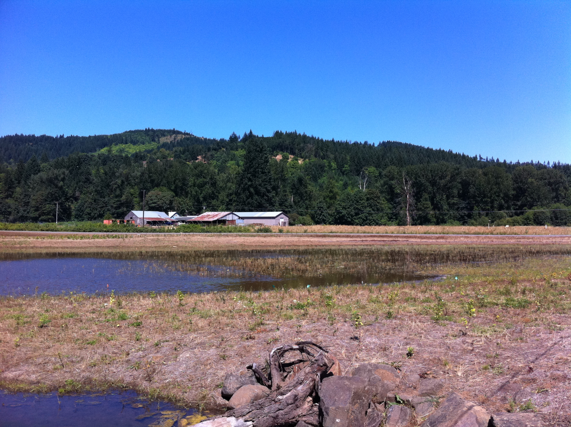
© Mattijs van Maasakkers.
In ecosystem service markets, the separation of credits from terra firma requires a precise definition of what is being traded and at what scale a credit can be used to offset an environmental impact. The spatial boundaries of an ecosystem service market, or how far from the site of impact the restoration location can be, ranges between local jurisdictional limits (as in the example of a trade between a sanitation district and a town government) to large watershed limits, and sometimes these boundaries are adjusted incrementally as the trading occurs (Robertson and Hayden 2008). Some of the most ambitious efforts to create large-scale, integrated markets for multiple ecosystem services have taken place in Oregon (van Maasakkers 2016), where state legislation (known as Senate Bill 513, passed in 2009), has explicitly encouraged their development.
The effects of ecosystem service markets are less readily visible, but potentially no less dramatic than those of TDR. The results of ESM can include the displacement of urban or near-urban environmental amenities, like wetlands and ecologically complex streams, to areas with low populations densities (King and Herbert 1997). However, given the diversity and complexity of precise institutional arrangements under the broader “ecosystem service markets” category, specific sociospatial outcomes can vary dramatically based on the specific market. An instructive example, widely touted at the time, is the use of “shade credits” to compensate for water-temperature increases in Oregon (van Maasakkers 2021). The municipal water-treatment utility in Medford, Oregon, was required, under the Clean Water Act, to reduce the water temperature in the Rogue River, into which it discharges its effluent. Warm water is considered a pollutant in much of the Pacific Northwest, as it threatens the survival of endangered species of salmonids. Following the logic of ecosystem service markets, the municipality chose to pursue the required water temperature reduction by providing funds for private landowners to plant trees along the banks of the Rogue River. Each tree would cast shade over the stream, thereby reducing water temperature incrementally. This transfer allowed the City of Medford to avoid costly investments in its water treatment facilities and effectively to continue to discharge warm(er) water into the river. The city council signed a contract with an environmental advocacy organization, which in turn sought private landowners far upstream from the urban water treatment facilities for the credit-generating tree-planting projects. These properties were targeted since the nonprofit partner of the City determined that narrow and relatively shallow streams, feeding into the Rogue River, were more likely to benefit from riparian tree-planting than the banks of the river inside the city limits. As a result of these decisions, the spatial effects of this ESM consisted of a transfer of roughly $8 million from urban ratepayers in a municipal water utility to private landowners far outside their jurisdiction. The investments made by the City, on behalf of its residents, are expected to lower the water temperature in the Rogue River, as required under the Clean Water Act. However, broader benefits of this tree-planting effort, like the aesthetic enhancement of existing green spaces or local air-quality improvements, are not available to the city’s residents as a result of the distance between the city of Medford and the private lands on which these trees have been planted, about 25 miles (40 km) on average (van Maasakkers 2021, p. 26). This example highlights how the emergence and implementation of these mechanisms can result in the transfer of resources, both monetary and ecological, from urban residents to rural landowners, with the explicit endorsement of the city’s elected officials.
Implications for planning
What are the implications of these market-based land-use instruments for planning practice? How do mechanisms like TDR and ESMs impinge on, and change, the governance of land, property, ecology?
First is the role of planning in shaping these new markets via regulatory regimes. Planning actions like zoning do not merely regulate markets; instead, they actively create markets and ultimately the cities and landscapes that emerge as a result (cf. Mackenzie, Muniesa and Siu 2007). There is immense work involved in the creation of new markets, and planners and planning techniques such as zoning definitions and spreadsheets enable the creation of new markets in air rights and pollution rights. Of direct relevance to land-use planning, these planning–legal maneuvers of separating the social and ecological value of land from a specific location force us to reconceptualize the very nature of land in land-use planning. When planners conduct land-use planning around TDR and ESMs, they are not dealing with land as terra firma, but are creating and regulating new markets of disembedded “land.”
Second, and related to the previous point, the creation of new markets in air and environmental rights is premised on the spatial conceit (cf. Robertson 2006) that the functions and meanings of land can be separated from location. In other words, the casting of shadows by the TDR-enabled skyscrapers and the ESM-enabled trees reveals the fallacy in these market abstractions that a development or pollution right remains the same irrespective of its location. These idiosyncratic outcomes expose the fault lines in these compensatory land-use mechanisms: that the public access to sunlight, clean air, and other public goods can be achieved by offsetting the social and ecological impacts elsewhere.
Third, as these market-based instruments gain popularity in various parts of the world, how should cities respond? Given the explosive rise of land financialization and speculation, there is an urgent need for efforts towards the decommodification of land. The TDR and ESM themselves emerged as responses to decommodify sites of social–ecological value such as historic landmarks and wetlands, but they were market-based responses: these instruments left unchallenged the idea of the “highest and best use of land” and instead resorted to new legal fictions of separation. In the case of TDRs, the unused development potential was delinked and transferred across space from one location to another; in ESMs, narrow functions such as the ecological benefits of riparian trees were separated from their locational specificity and offset elsewhere. As shown above, these market logics of separation are imbued with profound challenges, and produced, at best, idiosyncratic and, at worst, detrimental forms of land-use change. We contend that cities—and their elected officials, analysts, planners, and activists—should strive for, and work towards, an embedded understanding of land, where it is materially embedded within its social–ecological context. The logics of separation produce a narrow understanding of land, and run counter to a metropolitan politics of place.
We use these cases of TDR and ESM to make visible these fictions of separation, to question our very understanding of land in the making of these new markets, and to reclaim the ethics of land-use planning and decision-making in these times of market fundamentalism.
Bibliography
- Angotti, T.,and Morse, S. (eds.). 2017. Zoned Out!: Race, Displacement, and City Planning in New York City, New York: Terraform.
- BenDor, T. and Brozović, N. 2007. “Determinants of Spatial and Temporal Patterns in Compensatory Wetland Mitigation”, Environmental Management, vol. 40, no. 3, pp. 349–364. DOI: https://doi.org/10.1007/s00267-006-0310-y.
- BenDor, T. and Doyle, M. 2009. “Planning for Ecosystem Service Markets”, Journal of the American Planning Association, vol. 76, no. 1, pp. 59–72. DOI: https://doi.org/10.1080/01944360903360100.
- BenDor, T., Spurlock, D., Woodruff, S. C. and Olander, L. 2017. “A research agenda for ecosystem services in American environmental and land-use planning”, Cities, vol. 60, Part A, February, pp. 260–271. DOI: https://doi.org/10.1016/j.cities.2016.09.006.
- Callon, M. 2009. “Civilizing markets: carbon trading between in vitro and in vivo experiments”, Accounting, Organizations and Society, vol. 34, nos. 3–4, pp. 535–548. DOI: https://doi.org/10.1016/j.aos.2008.04.003.
- Chen, H. 2020. “Cashing in on the sky: financialization and urban air rights in the Taipei Metropolitan Area”, Regional Studies, vol. 54, no. 2, pp. 198–208.
- Costonis, J. 1974. Space Adrift: Landmark Preservation and the Marketplace, Champaign: University of Illinois Press.
- Dales, J. H. 1968. Pollution, Property & Prices: An Essay in Policy-Making and Economics, Toronto: University of Toronto Press.
- Freeman, J. and Kolstad, C. D. 2007. Moving to Markets in Environmental Regulation: Lessons from Twenty Years of Experience, New York: Oxford University Press.
- Furman Center for Real Estate and Urban Policy. 2013. Buying Sky: The Market for Transferable Development Rights in New York City, policy brief, October.
- Giordano, M. 1987. “Over-stuffing the envelope: the problems with creative transfer of development rights”, Fordham Urban Law Journal, vol. 16, no. 1, p. 43.
- Graham, S., and Hewitt, L. 2013. “Getting off the ground: on the politics of urban verticality”, Progress in Human Geography, vol. 37, no. 1, pp. 72–92.
- Hahn, R. W. and Hester, G. L. 1989. “Marketable Permits: Lessons for Theory and Practice”, Ecology Law Quarterly, vol. 16, no. 2, p. 361–406.
- Haila, A. 1991. “Four types of investment in land and property”, International Journal of Urban and Regional Research, vol. 15, no. 3, pp. 343–365. DOI: https://doi.org/10.1111/j.1468-2427.1991.tb00643.x.
- Hirsch, D. 2008. “Ecosystem Services and the Green City”, in E. Birch and S. Wachter (eds.), Growing Greener Cities: Urban Sustainability in the Twenty-First Century, Philadelphia: University of Pennsylvania Press.
- Jarvie, M. and Solomon, B. 1998. “Point–nonpoint effluent trading in watersheds: a review and critique”, Environmental Impact Assessment Review, vol. 18, no. 2, pp. 135-157. DOI: https://doi.org/10.1016/S0195-9255(97)00084.
- Kaiser, E. J. and Godschalk, D. R. 1995. “Twentieth-Century Land-Use Planning: A Stalwart Family Tree”, Journal of the American Planning Association, vol. 61, no. 3, pp. 365–385. DOI: https://doi.org/10.1080/01944369508975648.
- Kim, A. 2015. Sidewalk City: Remapping Public space in Ho Chi Minh City, Chicago: University of Chicago Press.
- King, D. and Herbert, L. 1997. “The Fungibility of Wetlands”, National Wetlands Newsletter – Environmental Law Institute, vol. 19, no. 5, pp. 10–13.
- Lave, Rebecca. 2014. “Neoliberal Confluences: The Turbulent Evolution of Stream Mitigation Banking in the US”, Political Power and Social Theory, vol. 27, pp. 59–88. DOI: https://doi.org/10.1108/S0198-871920140000027010.
- Lynch, K. and Hack, G. 1984. Site Planning, Cambridge (Massachusetts): MIT Press.
- MacKenzie, D., Muniesa, F. and Siu, L. (eds.). 2008. Do Economists Make Markets?: On the Performativity of Economics, Princeton: Princeton University Press.
- Marcus, N. 1983. “Air rights in New York City: TDR, zoning lot merger and the well-considered plan”, Brooklyn Law Review, vol. 50, no. 4, pp. 867–879.
- Municipal Art Society of New York, The. 2013. Accidental Skyline: A Blueprint for a More Intentional City.
- Popper, F. 1988. “Understanding American Land-Use Regulation Since 1970: A Revisionist Interpretation”, Journal of the American Planning Association, vol. 54, no. 3, pp. 291–301. DOI: https://doi.org/10.1080/01944368808976490.
- Radin, M. 1982. “Property and Personhood”, Stanford Law Review, vol. 34, no. 5, pp. 957–1015.
- Rea, C. M. 2017. “Theorizing command-and-commodify regulation: the case of species conservation banking in the United States”, Theory and Society, vol. 46, no. 1, pp. 21–56. DOI: https://doi.org/10.1007/s11186-017-9283-5.
- Robertson, M. and Hayden, N. 2008. “Evaluation of a Market in Wetland Credits: Entrepreneurial Banking in Chicago”, Conservation Biology, vol. 22, no. 3, pp. 636–646. DOI: https://doi.org/10.1111/j.1523-1739.2008.00963.x.
- Robertson, M. 2006. “The nature that capital can see: science, state, and market in the commodification of ecosystem services”, Environment and Planning D: Society and Space, vol. 24, no. 3, pp. 367–387. DOI: https://doi.org/10.1068/d3304.
- Sandercock, L. 2003. “The power of story in planning”, chap. 8, Cosmopolis II: Mongrel Cities in the 21st Century, London: A&C Black, pp. 181–204.
- Sorkin, M. 2018. “The Fungibility of Air”, chap. 12, What Goes Up: The Right and Wrongs to the City, London/New York: Verso: pp. 65–72.
- Tietenberg, T. H. 1980. “Transferable Discharge Permits and the Control of Stationary-Source Air Pollution: A Survey and Synthesis”, Land Economics, no. 56, pp. 391–416.
- Tietenberg, T. H. 1985. Emissions Trading, an Exercise in Reforming Pollution Policy, Washington, DC: Resources for the Future.
- van Maasakkers, M. 2016. The Creation of Markets for Ecosystem Services in the United States: The Challenge of Trading Places, New York: Anthem Press.
- van Maasakkers, M. 2021. “What Role Does Planning Have in the Creation of Ecosystem Service Markets? Evidence from Two Cases in Oregon”, Journal of Planning Education and Research, vol. 41, no. 1, pp. 18–31 (first published online on 17 May 2018). DOI: https://doi.org/10.1177/0739456X18773502.
- Wolford, W. 2007. “Land Reform in the Time of Neoliberalism: A Many-Splendored Thing”, Antipode, vol. 39, no. 3, pp. 550–570. DOI: https://doi.org/10.1111/j.1467-8330.2007.00539.x.


